Importance of the Municipal Asset Management Program

Infrastructure is constantly expanding in new and exciting ways, with things like 5G being at the forefront of these expansions. Building infrastructure is one of the most important prerequisites for a flourishing economy, however managing this infrastructure is equally as important. Given the constant need for infrastructure, municipalities need tools and resources to make objective decisions that support long-term asset management and build a more prosperous future for all Canadians.

Urban systems like water, waste and gas must always be efficient and sustainable. It is important to ensure that these assets are managed properly in order to avoid service interruptions and ensure safety. However, there are many communities that require assistance in terms of managing their legacy infrastructure. Perhaps this is why the Government of Canada is investing $590,510 in 17 New Brunswick communities to assist with asset management. The long-term goal is to help these smaller communities make calculated decisions when it comes to infrastructure performance. 

Readers can learn more about these 17 projects here

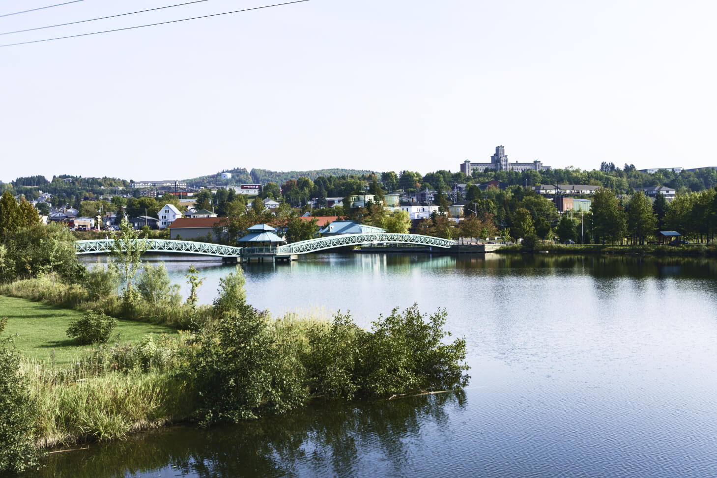
The Edmundston–Madawaska Bridge in New Brunswick

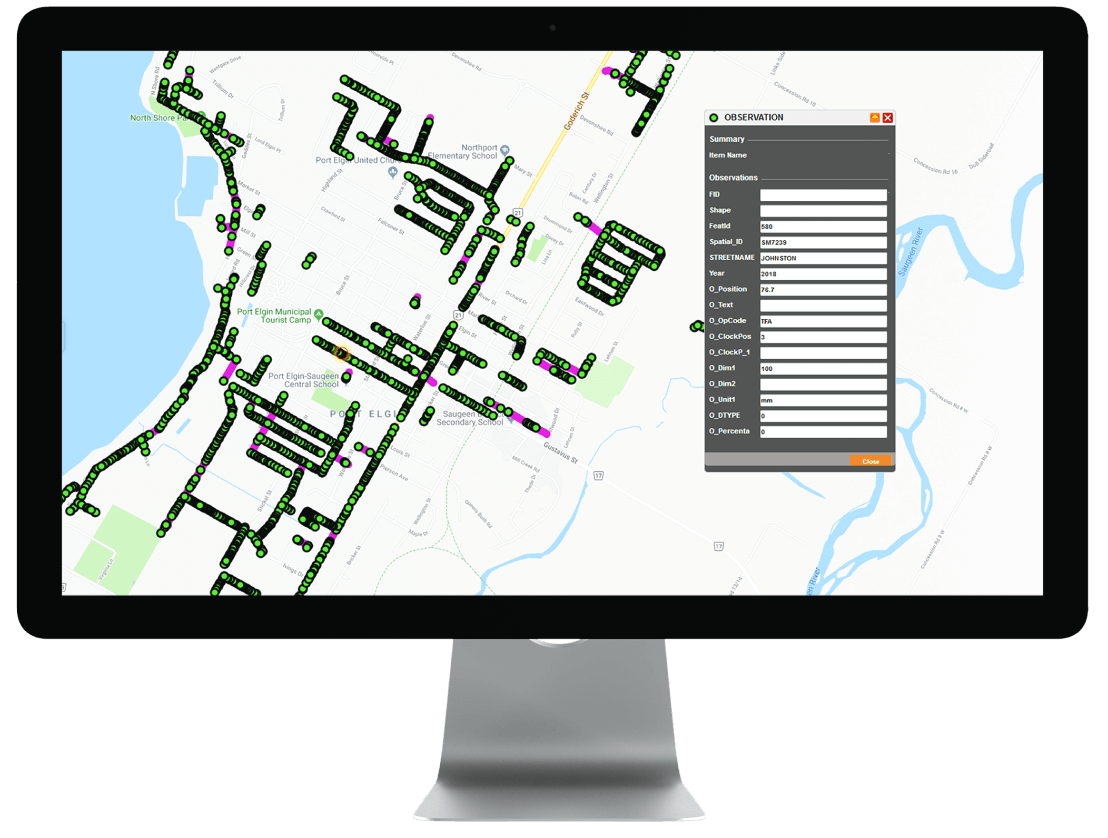
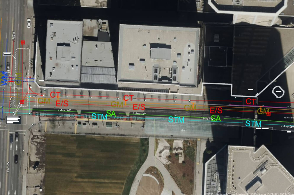
Tierra is a strong proponent for asset management, offering a wide range of asset management, integrity services and data integration services. Tierra has the ability to collect asset data, visually assess situations and integrate data within legacy systems. Tierra offers even more advanced asset management services for clients who require a full 360˚ solution. If you are planning a project and interested in our services, please do not hesitate to reach out and ask. We are happy to discuss our services and process!

Get in Touch
Want to learn how Tierra can help you?

What is Geospatial data?

Geospatial data is information about objects, events, or phenomena that have a physical location on the earth’s surface. The location may be static in the short term (for example, the location of a road, an earthquake event, or children living in poverty) or dynamic in the long term (e.g., a moving vehicle or pedestrian, the spread of an infectious disease, etc.). Geospatial data combines location information (usually earth coordinates), attribute information (the characteristics of the object, event, or phenomenon in question), and, in some cases, temporal information (the time or life span at which the location and attributes exist).

Geospatial data typically consists of large sets of spatial data gathered from various sources in various formats, including information such as census data, satellite imagery, weather data, cell phone data, drawn images, and social media data. Geospatial data is most useful when found, shared, analyzed, and applied alongside traditional business data. Many types of geospatial data sets are of general interest to a wide range of users. Roads, localities, bodies of water, and public amenities, for example, can be used as reference information for several purposes.

How Geospatial Data is Used?

Geospatial data can be used and represented in a variety of ways. It’s most commonly used within a GIS (geographic information system) to understand spatial relationships and create maps that depict these relationships. A GIS can also assist you in managing, customizing, and analyzing geospatial data. These analytics are used to augment traditional types of data with timing and location and create data visualizations. Maps, graphs, statistics, and cartograms are examples of visualizations that show historical and current changes. This additional context provides a more complete picture of what’s happening. Insights that might be missed in a large spreadsheet are revealed in simple visual patterns and images. Therefore predictions can be made faster, easier, and more accurately as a result of this.

Some examples of geospatial data include

  • Vectors and attributes: Descriptive information about a location such as points, lines and polygons
  • Point clouds: A collection of co-located charted points that can be recontextured as 3D models
  • Raster and satellite imagery: High-resolution aerial photographs of our world, taken from above
  • Census data: Released census data tied to specific geographic areas for the study of community trends
  • Cell phone data: Satellite-routed calls based on GPS coordinates
  • Drawn images: CAD images of buildings or other structures that provide both geographic and architectural data.
  • Social media data: Posts on social media that data scientists can analyze to identify emerging trends.

GIS-related project for one of Tierra’s clients 

How does Tierra work with Geospatial data?

Tierra offers a range of professional services that produce timely and precise underground information for utilities, municipalities, engineers, surveyors, project owners and private property owners. Tierra is able to collect underground asset information and integrate it into Web-GIS. Web-GIS allows users to visualize data in realtime to asset management, tickets, permitting and much more. 

The fundamental objective of Tierra is to provide its clients with the best and most efficient solution, with considering values such as:

  • Public and employee safety.
  • Courteous customer service.
  • High-quality and cost-efficient solutions.
  • User-friendly and environmentally friendly technologies.
Get in Touch
Want to learn how Tierra can help you?

What is Subsurface Utility Engineering (SUE)?

Subsurface Utility Engineering (SUE) is an engineering method for determining the location of subsurface utilities within a project area with greater accuracy. This lays the groundwork for building design considerations, allowing a designer to make critical decisions early on about coordination, accommodation, and relocation for utilities. Simply said, Subsurface Utility Engineering reduces project risk and eliminates unexpected costs later on. 

Either on a contract or an as-needed basis, Tierra offers a broad range of professional underground Utility surveys, designation and mapping services (Subsurface Utility Engineering) to municipalities, Utilities and infrastructure owners across North America and internationally. Tierra employs several professional and certified SUE technicians, geophysicists, surveyors and engineers, equipped with state-of-the-art and proprietary G.I.S. and data collection technologies giving them an edge in the industry. 

What does SUE include?

Simply put, there are four levels based on the CI/ASCE 38-02 Standard Guideline for the Collection and Depiction of Existing Subsurface Utility Data, and they are as follows: 

  • SUE Level D: which comprises of record research and review
  • SUE Level C: which comprises of mapping and as-built creation
  • SUE Level B: which comprises of geophysical investigation
  • SUE Level A: which comprises of conflict investigation and daylighting

What matters most is that Quality Levels are completed in the correct order – D, C, B, and A. This is the most efficient method of reducing risk and avoiding repetition. In addition, data from Level D and Level C investigations are combined, allowing for the detection of abnormalities and gathering information needed to conduct a targeted, well-informed Level B study. Therefore, Tierra offers all quality levels of SUE (A, B, C, D) to verify the horizontal and vertical position and depth of all subsurface infrastructure, including non-toneable underground assets.

Tierra is also offering a combined Subsurface Utility Engineering Level A & B with Route Validation to various construction clients to expedite construction and FTTH projects. Combining Hydro Vac crews with qualified senior locators who can further verify line routes and propose drill paths to avoid conflict with other utilities.

To learn more about SUE and other types of services that Tierra offers, you can visit our website or contact us, and we can provide you with an in-depth walk-through to better provide you with the resources that make your projects quicker and cost-efficient.

Get in Touch
Want to learn how Tierra can help you?

How Tierra Supports the Deployment of 5G in Canada

How Tierra Supports the Deployment of 5G in Canada

5G has recently become all the rage, and for good reasons- this technology can help push the Canadian economy forward. With greater access to businesses, consumers, and students with a 5G network will benefit from peak speeds of up to 1.7 Gbps, facilitating remote work, virtual health, and distant education. 5G also promises to create 250,000 Canadian jobs and contribute $40 billion to the country’s economy annually by 2026. All the major network providers are competing to get in quickly to grab that first-mover competitive advantage. 

All three major providers, Rogers, Bell & Telus, plan to take on this significant infrastructure change over the next year. In addition, Tierra has upheld some great relationships with all the major network providers and utility providers, serving the Canadian industry with a range of professional services that produce timely and precise underground information. This includes services for utilities, municipalities, engineers, surveyors, project owners and private property owners. Tierra, and its affiliated companies, can offer services such as 5G tower construction, subsurface utility engineering, locating, mapping, daylighting, and more.

However, this accessibility would be first seen by the major cities such as Vancouver, Montreal, Calgary, Edmonton, and the Greater Toronto Area. In addition, all three of these major networks have plans on expanding to reach the smaller towns and cities across the country very soon. This is where our services step in, and Tierra can eliminate any red tape and get these projects moving faster by eliminating downtime during construction while promoting public safety.

The inability to obtain reliable underground utility information has long been troublesome for many network providers. It is negatively affecting lives in the form of costly damages and claims, service eruptions and lengthy construction projects. The fundamental objective of Tierra is to provide its clients with the best and most efficient solution, considering values such as public and employee safety, courteous customer service, high-quality and cost-efficient solutions, user-friendly and environmentally friendly technologies.

To learn more about the types of services, you can visit our website or contact us, and we can provide you with an in-depth walk-through to better provide you with the resources that make your projects quicker and cost-efficient.

Get in Touch
Want to learn how Tierra can help you?